People who live along the Ohio River seldom get surprised when the Ohio decides to overflow its banks. Seems like it happens every year. Even 2008 has been a hard year for floods in this region with schools closing occasionally and homes damaged or roads underwater.
The Evansville Daily Courier reported in 1884 that the towns of Smithland in Kentucky, and Golconda, Elizabethtown, New Liberty, and Shawneetown in Illinois were partly underwater. In 1913 the town of Caseyville in Union County was nearly destroyed. The town hall floated away and when the local livery stable started to float away it was caught and tied to a tree. The 1937 flood played a part in the demise of the town of Weston in Crittendon County, Kentucky.
Most people consider the 1937 flood to be the worst flood ever to occur on the Ohio River. But it is not the only one that occurred. Records show that there were many other floods that occurred in…….
- 1773
- 1788
- 1789
- 1793
- 1811
- 1832
- 1847
- 1862
- 1881
- 1882
- 1883
- 1884
- 1907
- 1913 there were 2 floods. One in January with the 2nd one 3 months later.
- 1918 there were back to back floods. It is these 2 floods that basically destroyed the steamboat commerce along the Ohio as many steamboats were destroyed in these floods. There had been much ice from snowstorms that year. As it thawed and began to flow down the Ohio many ice jams occurred. These jams then trapped many steamboats and basically crushed them to pieces.
- 1933
- 1936 on March 28
- 1937 January to February
- 1945
- 1948
- 1955
- 1964
- 1996
- 1997
Although this site has numerous photos of the 1937 flood as it affected Mt. Vernon, Indiana this is but a handful of thoughts as pertains to this awful catastrophe. With the following it is hoped to inform the reader of the true extent of what occurred and how badly people in this region were affected. The Oho River flood of 1937 took place in January and February of 1937. Damage stretched from Pittsburgh on the Ohio River all the way to Cairo, Illinois.
The above information culled from numerous articles of the Cincinnati Enquirer, The Kentucky Climate Center, NOAA’s National Weather Service Weather Forecast Office, Louisville, Kentucky, OhioHistoryCentral.org, Ohiohistory.org, The Ohio Historical Society, Southern Illinois University Carbondale, University of Indiana Archives, WPA Archives, believe the sign.com, Williambranhamhomepage.org, Hamilton-co.org, special.library.louisville.edu, higginsportohio.com, earthobservatory.nasa.com, tva.gov, w3.iac.net, wheeling.weirton.lib.wv.us, The Indiana Department of Homeland Security, in.water.usgs.gov, indystar.com, fema.gov, newslinkindiana.com, tiffinohio.com, Western Kentucky University Archives, ohiolink.edu, waymarking.com, gendisasters.com, electricearl.com, uscg.com, Evansville.net, courierpress.com, and miscellaneous other sites.
Information as supplied by Wikipedia states-
- After the 1937 flood…………
- 1 million left homeless
- 385 deaths from the flood
- Property losses reached $500 million
- Further worsened as this occurred during the Great Depression and just a few years after the Dust Bowl
The 1937 Flood List of Events…
| Jan 5: | Water begins to rise |
| Jan 10: | Severe winter storm affects Southern Indian with snow, sleet, and heavy rains |
| Jan 10-18: | Many flood warnings issued |
| Jan 13-24: | Near record rainfalls recorded |
| Jan 18: | Many homes flooded as Ohio begins to overflow its banks |
| Jan 23-24: | Water at 54 feet. Martial law declared in Evansville, Indiana |
| Jan 26: | Water 80 feet at Cincinnati. Highest in city’s history. |
| Jan 27: | New record when water 57 feet at Louisville. 70% of city under water at this time. |
| Feb 2: | Water over 60 feet at Paducah, Kentucky |
| Feb 5: | Water falls below flood stage first time in over three weeks in many places. |
Response By Media Groups
Many thanks go out to several powerful radio stations operating at this time like WLW and WHAS. It has been recorded that they switched to non-stop 24 hour a day broadcasting. They basically started non-stop news casting of situations about the entire lower Ohio Valley area. This went on for over three weeks commercial free. It was for most civic agencies their only method available to send messages to individual units operating along the Ohio working in rescue efforts.
Response By the Government After
The 1937 flood of the Ohio River was considered to be unprecedented in nature. A majority of all the civic and business groups along the Ohio forced authorities to create what was considered to be a comprehensive plan to prevent any form of reoccurrence of this major disaster. As a result it was decided to create more than 70 storage reservoirs along the route of the Ohio River. The plan was not complete by the Army Corps of Engineers until the early 1940s. It seems to have been somewhat successful in efforts taken and has drastically reduced flood damages ever since their creation.
WIKIPEDIA records the following information about the flood for the states of Ohio, Indiana, Illinois, and Kentucky.
Ohio
100,000 in Cincinnati were left homeless, as the flood impacted the city from January 18 to February 5. The river reached its peak on January 26, at 79.9 feet (24.4 m). Ohio River levels on January 26-27 were the highest known from Gallipolis downstream past Cincinnati. Crests were 20 to 28 feet (8.5 m) above flood stage and 4 to 9 feet (2.7 m) above previous records. Six to 12 inches (300 mm) of rain fell in Ohio during January 13-25, 1937, totals never before or since experienced over such a large area of Ohio. January 1937 remains as the wettest month ever recorded in Ohio. The Ohio River crested at 80 feet (24 m) at Cincinnati on January 26. This was 28 feet (8.5 m) over flood stage and 9 feet (2.7 m) above the 1884 record. More than 50,000 were homeless, 10% of the city was inundated, water supply was cut, and streetcar service was curtailed. At Portsmouth, it became clear that the flood wall, erected 10 feet (3.0 m) above flood stage, would be topped by the rising river. City officials deliberately opened the flood gates and allowed river water to flood the business district 8 to 10 feet (3.0 m) deep, thus preventing a catastrophic breaching of the flood wall. The Ohio River eventually crested 14 feet (4.3 m) over the top of the floodwall. Among the flood structures was Crosley Field, home field of the Cincinnati Reds baseball team. The death toll of 10 was remarkably low for such a devastating flood and contrasts sharply with the 467 killed in the floods of March 1913.
Kentucky
Louisville, Kentucky during the 1937 flood
Several businesses in the Louisville area were devastated, especially the famed Rose Island amusement park (actually on the Indiana side of the river near Charlestown), which never rebuilt. The flood affects the development of Louisville even to this day. The flood caused much of the initial rebuilding of the city to be directed toward the east out of the flood plain, partially contributing to a long-term concentration of wealth there and away from the older central and western areas of the city.
The Ohio River at Paducah rose above its 50-foot (15 m) flood stage on January 21, cresting at 60.8 feet (18.5 m) on February 2 and receding again to 50 feet (15 m) on February 15. For nearly three weeks, 27,000 residents were forced to flee to stay with friends and relatives in higher ground in McCracken County or in other counties. Some shelters were provided by the American Red Cross and local churches. Buildings in downtown Paducah still bear plaques that highlight the high water marks.
With 18 inches (460 mm) of rainfall in 16 days, along with sheets of swiftly moving ice the '37 flood was the worst natural disaster in Paducah's history. Because Paducah's earthen levee was ineffective against this flood, the United States Army Corps of Engineers was commissioned to build the flood wall that now protects the city from the ravages of flooding.
Indiana
The river rose to a record 53.74 feet (16.38 m), which was 19 feet (5.8 m) above flood stage, and sent water over the six-month old riverfront plaza in Evansville. Martial law was declared on January 24th and 4,000 WPA workers were sent to Evansville. After the flood, the Evansville-Vanderburgh Levee Authority District was established, which built a system of earth levees, concrete walls, and pumping stations meant to protect the city. Jeffersonville, Indiana alone saw 1,000 WPA workers come to rescue the city. $500,000 of federal money was expended in Jeffersonville, and $70,000 was sent to New Albany. The Pennsylvania Railroad evacuated many citizens by train from its depot in Jeffersonville. Many small riverside towns like Mauckport and New Amsterdam were so devastated that they never recovered.
Illinois
Flooding along the Ohio River has plagued Harrisburg over the years. The city was flooded in 1883-1884 and again in 1913. Its most severe flood came in 1937 when much of the city, except "Crusoes's Island", was underwater. After that, a levee was erected north and east of the city to protect it from future floods. The levee became the official northern and eastern border of the town. Many people were surprised that water from the river could reach that far inland, nearly 30 miles (48 km) inland. Harrisburg was nearly wiped off the map.
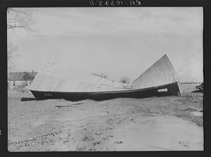
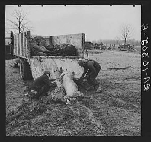
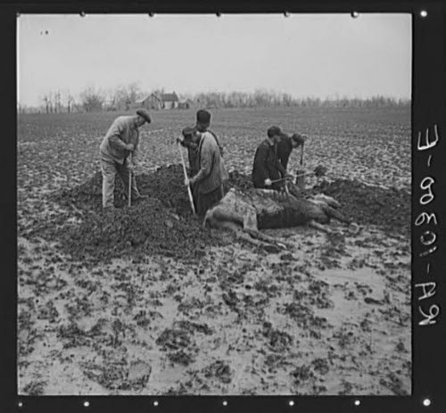
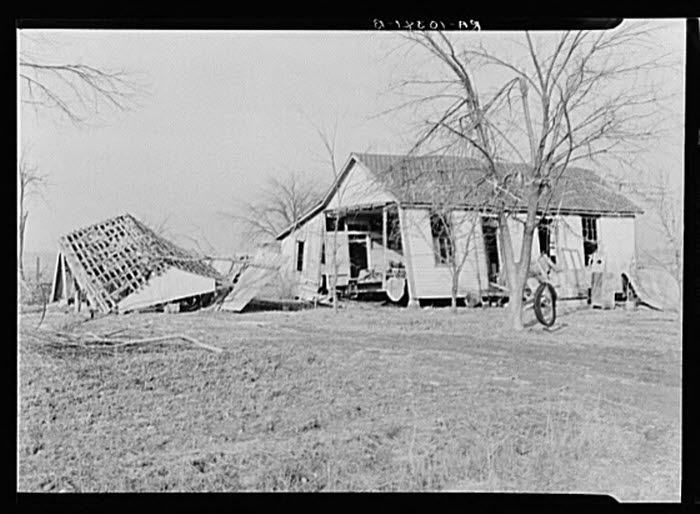
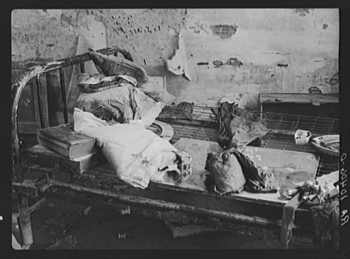
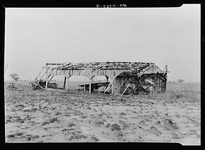
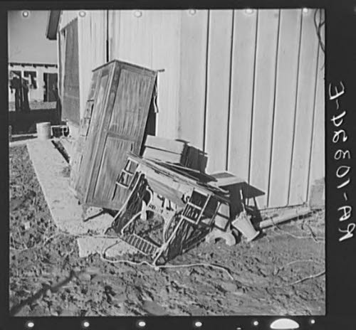
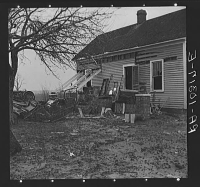
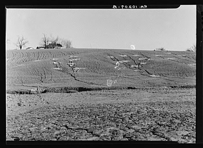
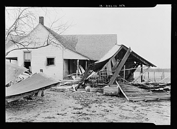
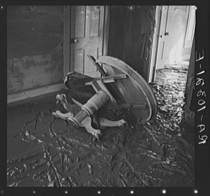
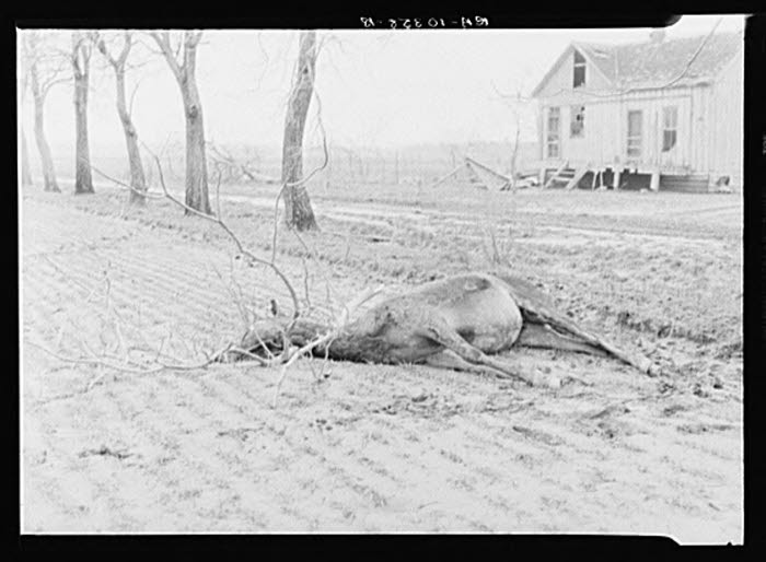
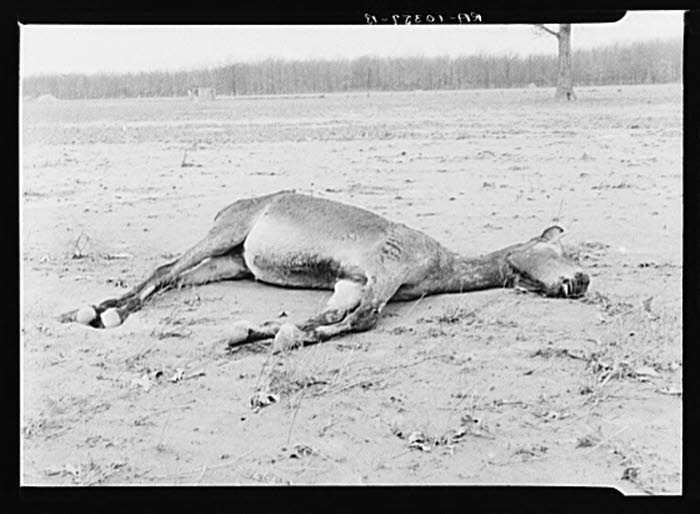
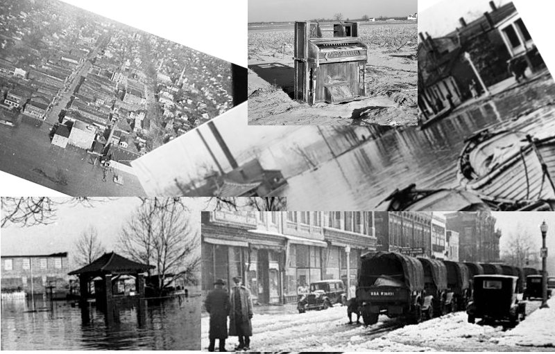
At this time we would ask you to view the actual photos of the devastation a flood like the one in 1937 can impose upon people like those in towns like Mt. Vernon, Indiana. Things like this should never be forgotten and this is our small effort towards that goal. And as always thank you for visiting our site.
Click on a picture in a section to see larger versions of that set. To navigate within the section of pictures, move mouse over right or left margin to see Prev or Next.
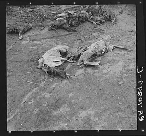
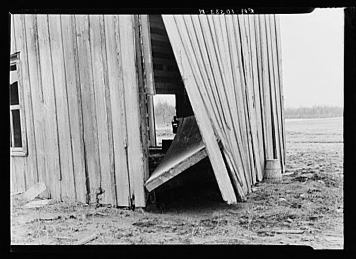
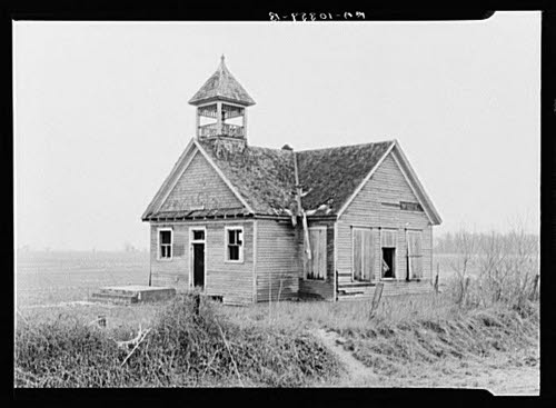
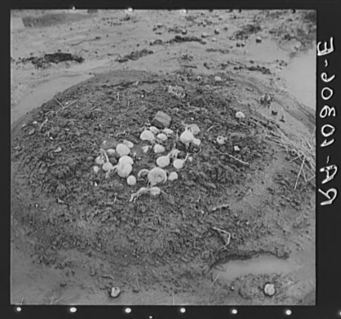
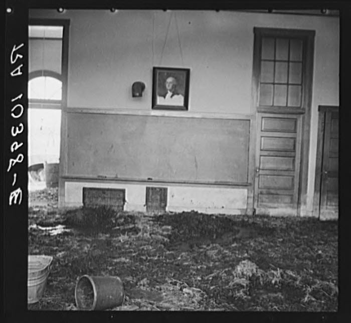
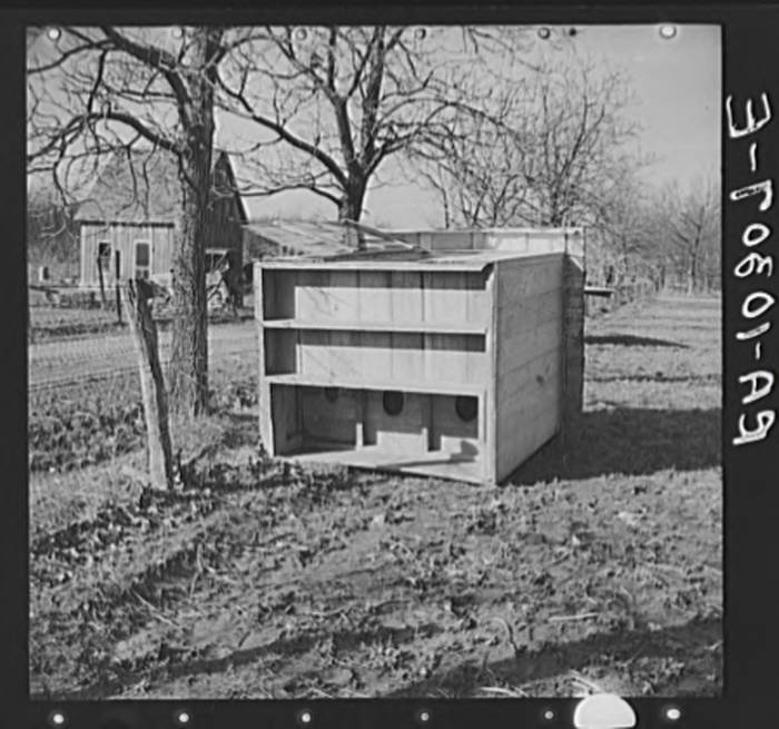
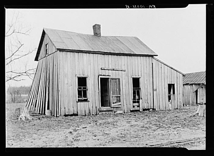
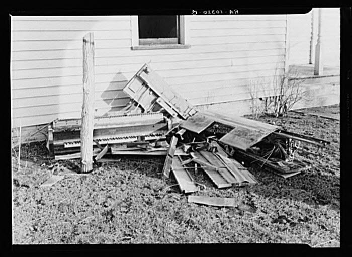
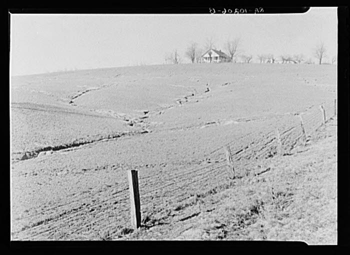
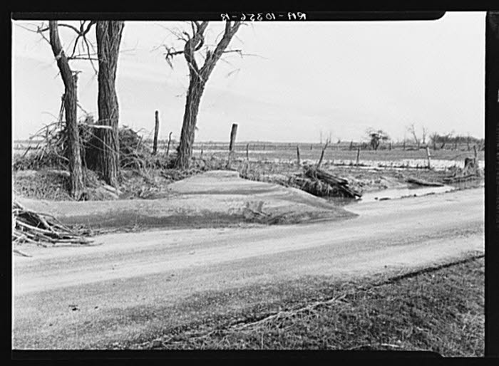
Miscellaneous Pictures
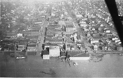
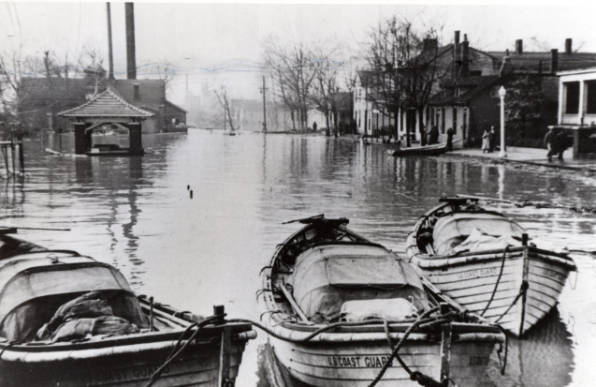
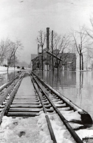
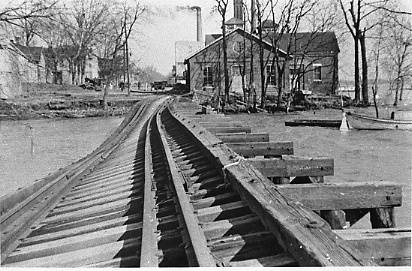
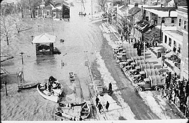
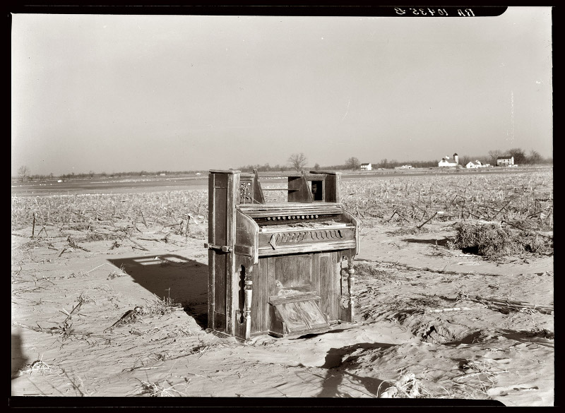
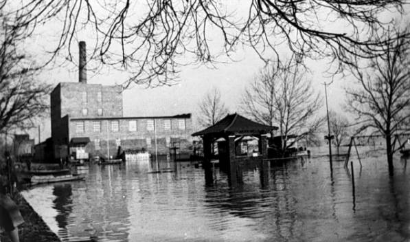
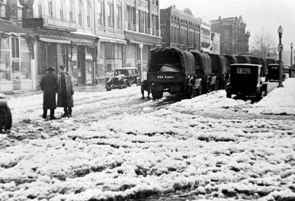
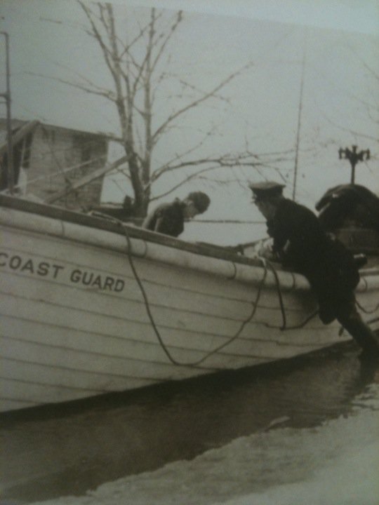
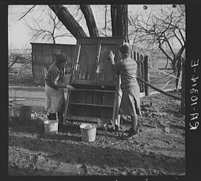
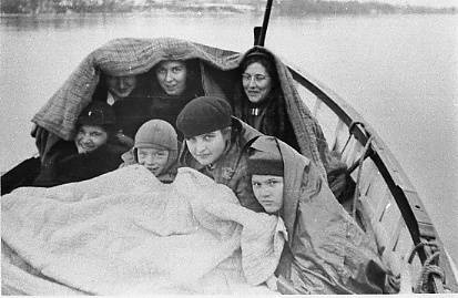
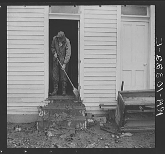
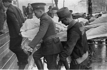
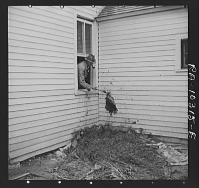
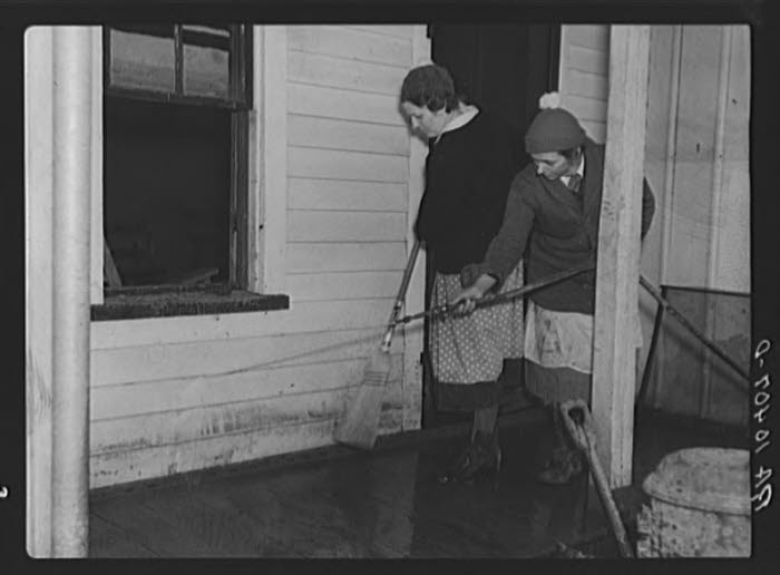
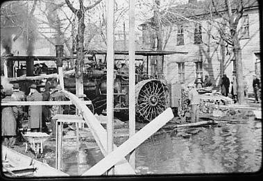
Much of the loss and devastation was to property, livestock and food stores, as these pictures reveal.